agung mountain
 is the highest mountain on the island of Bali with a height of 3142 masl. The mountain is located in the district of rendang, the district of Karangasem - Bali.
Majestic mountain is a stratovolcano volcano, this volcano has a crater a very large and very deep that sometimes smoke and water vapor. From this mountain temple Besakih.Rute look perfect with a pointed cone, but the actual peak of this mountain elongated and ends in a circular craters and wide.
From the top we can see the majestic mountain peaks rinjani located on the island of Lombok to the east, although both mountains covered with clouds because both peaks are above the clouds, Nusa Penida island in the south and its beaches, including beach and mountain sanur and lakes on the northwest shelf
 Tangkuban Perahu
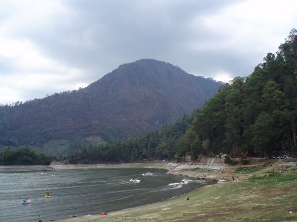
 crater is one of the attractions located in the southern district. Subang, located at an altitude of 2084 m above sea level. The beauty of nature with a row of craters that stretches and cool mountain air and stretch typical of other mountains towering around it and the many collections of herbs and plants typical of tropical forest that flourished around the crater, making the mountain Tangkuban boat as an attractive tourist destination in Earring district.
Viewed from the city of Bandung, Tangkuban Mt has a unique shape that resembles a boat upside down (sundanese: Tangkuban = inverted, Parahu = boat). Unique shape is believed to have a very close connection with the story of legend sangkuriang.
Enjoying views of the crater of Mount Tangkuban queen boat, like seeing a giant bowl of very large and deep. When the weather is sunny, the curve of the soil on the crater wall as well as the bottom of the crater can be seen quite clearly so as to present the spectacular panoramic views. Grandeur of the crater is so vast and deep, at least able to force the viewer to a moment silent and amazed by the greatness of the work of god.

bintan mountain located in the village bekapur, bintan buyu village, sub-bay bintan, bintan district is actually more like a hill, because peak height is only about 400m above sea level.
However this hill is a 'mountain' highest in bintan island. Top of the hill could be reached only in about 2 hours.
There are some interesting things that can be found throughout the ascent. The most important, of course, when being at the top we can enjoy the beautiful scenery, because from the top of this hill we could see kesekeliling bintan island.
Besides the beautiful scenery at the summit, the mountain bintan is also a tropical rain forest inhabited by a variety of flora and fauna.
We can easily find various kinds of tropical plants and giant trees and various animals such as monkeys, squirrels, snakes, pelanduk, various species of birds, etc.. The activity of this tour we also can learn about the tropical rain forest ecosystem.
 Gamalama mountain
 is one of the volcanoes in the province of North Maluku. In addition to this mountain, there are mountain districts halmahera Gamkonora in the west, mountains and mountain dakona mothers residing in the district halmahera north, and mountains in halmahera kiebesi south. Mount Gamalama itself is located on the island of Ternate and has a height of about 1715 m asl (above sea level).
In addition to stunning scenery, the climbers will also find unique places on the mountain. Among them is a stone fountain in the square baking dish large indentation, which the local people called abdas spring. That said, these springs can cure many diseases. So, I wonder if the people of Ternate so mengkeramatkan this spring. Thus, there are certain rules to take water from springs abdas, which should not be scrambled, and each person is only allowed to take one bottle.
In addition abdas springs, other points of interest is the grave of ancestor society Ternate, which was hundreds of years old. Unknown, why these graves could exist on a mountain top Gamalama. But certainly, the people of Ternate very mengeramatkan graves. Many people who climb mountains Ternate Gamalama for pilgrimage at the tomb of this ancestor.
Mount Gamalama located in the city of Ternate, North Maluku province, Indonesia. If you want to make the climb, climbing lines can be accessed from several nearby villages, such as the village of Moya, malikurubu village, and village akehuda. However, from these three villages, if you want the easiest route to the village of mayo.
 Lawu mountain
 (3265 m) located on the island of Java, Indonesia, precisely in the border province of Central Java and East Java. Status of this mountain is a mountain of fire "resting" and has long been inactive, visible from the dense vegetation and eroded its peak. On the slopes there is a small crater that still produce water vapor (fumaroles) and sulfur (solfatara). Mount Lawu have a hill dipterocarp forest, upper dipterocarp forest, montane forest, and ericaceous forests.
Lawu mountain has two peaks, peak Hargo Dalem and Hargo Dumilah. The latter is the highest peak.
On the slopes there are a number of places are popular as tourist destinations, especially in the area tawangmangu, cemorosewu, and Sarangan. A bit down, on the west side there are two complex enshrinement of late majapahit: Temple Sukuh and temples Cetho. At the foot of the mountain is well located complex diocesan cemetery relatives mangkunagaran: Astana girilayu and Mangadeg cemetery. Near the complex is located Astana Giribangun, family mausoleums for Indonesia's second president, Suharto.
 peak
peak which is also listed as one of the seven continents peak (seven summit), which is phenomenal and the target of mountaineers around the world. Jayawijaya Peak is located in national parks Laurentz, papua. The peak was covered by eternal snow. Eternal snow on top of Jayawijaya is one of three fields of snow in the tropics which are in the world. In our country it traversed the equator, watch the snow in Indonesia certainly something that is impossible to be understood. Carstenz pyramid (4884 masl) is one of those snowy peaks. The highest peak in Southeast Asia and the Pacific is located in the mountains sudirman. Peak is famous not only because of the high, but also because there is a layer of snow on the peak.
Mount Kerinci is the highest volcano in Indonesia with an altitude of 3800m above sea level and is still in an active state. Located at latitude 10 ° 45.50 'latitude and 160 ° 1010' east longitude. Located in two districts of Kerinci and Sulak Running. At the foot of this mountain you can find tea plantations located in the village Kersik Tuo.
Mount Kerinci are under the protection of Kerinci Semblat Nasioanal Park. On this mountain forest areas we can still find the Sumatran tiger. One thing that should be in mind, if you climb this mountain, do not spend the night or put up tents in the shelter area I or area below 1500m altitude above sea level.
Because this area is the habitat of the Sumatran tiger and where they hunt. And try not to bring food that smells rancid or raw meat.
The view from the summit of Kerinci very spectacular, we could see the lake and lake
Kerinci situjuh above the top of the hill situjuh, and in the southern part looks Lubuk Gadang and Muara Labuh.
While in the west Indian Ocean visible. very beautiful. Mount Kerinci can be achieved through the city or town of Padang, Jambi, or also from Muara Bungo. Muara Bungo Sumatra Cross located on the road between the provinces of Jambi and West Sumatra.
Mount Kelud (often disalahtuliskan be Kelut which means "broom" in the Java language, in Dutch called Klut, Cloot, Kloet, or Kloete) is a volcano in East Java province, Indonesia, which is still active. The mountain is located on the border between Kediri and Blitar regency, about 27 km east of downtown Kediri.
Mount Kelud is one of the leading attractions Kab. Kediri. Located in the village of Sugihwaras, Kec. Ngancar, east of Kediri.
From the City via the District of Kediri. Plosoklaten, Kec. Wates to the district. Ngancar - / + 27 km, from the district. Ngancar towards the village of Sugihwaras - / + 5 km, and from village to tourism Sugihwaras crater G. Kelud - / + 5 km. Also far enough, yes.
Mount Bromo is one tourist destination in East Java. Natural attractions are located in the Bromo Tengger Semeru National Park in the eastern city of Malang, East Java. The crowd was not only local tourists, even many who come from abroad. With a view of a typical make Bromo worthy of being a tourist destination
Mount Bromo (from Sanskrit / Old Javanese: Brahma, one of the main Hindu gods), the volcano is still active and most famous as a tourist attraction in East Java. As a tourist attraction, Mount Bromo become attractive because of its status as the volcano is still active.
Bromo has a height of 2392 meters above sea level is located in four regions, namely Probolinggo, Pasuruan, Lumajang, and Malang. Mount Bromo mesh body shape between valleys and canyons with the caldera or the sea of sand covering some 10 square kilometers.
Mount Bromo has a crater with a diameter of ± 800 feet (north-south) and ± 600 meters (east-west). While the danger area of a circle
Name List of High Mountains in IndonesiaHigh Atlas Mountains is located in the Aceh Province
High Mountains Barui Located in Central Sulawesi Province
Located in the High Mountains Batak of North Sumatra Province
High Mountains Bingkoku Located in Southeast Sulawesi Province
High Mountains Bone Located in South Sulawesi Province
High Bukit Barisan Mountains situated in the province of Bengkulu
High Mountains Charles Louis Located in Papua Province
High Mountains Located Cianjur in West Java Province
High Mountains Dieng Located in Central Java Province
Gayo Mountain High is located in the Aceh Province
High Mountains Jayawijaya Located in Papua Province
High Mountains Located Kapuas Hulu in West Kalimantan Province
High mountainous Karo Located in North Sumatra Province
High mountains of the Kerinci Located in West Sumatra Province
High Mountains Luwu Located in South Sulawesi Province
Mountain High is located in Magelang, Central Java Province
High Mountains Located Malang in East Java Province
High Mountains Located Minahasa in North Sulawesi Province
Located in the High Mountains Minangkabau of West Sumatra Province
High Mountains Muller Located in West Kalimantan Province
High Mountains Pasai Located in the Aceh Province
High Mountains Penreng Located in Central Sulawesi Province
High Mountains Priangan Located in West Java Province
High Mountains Skhwaner Located in West Kalimantan Province
Located in the High Mountains of Papua Province Sudirman
High Mountains Sumedang Located in West Java Province
High Tengger Mountains Located in East Java Province
High Mountains Wajo Located in South Sulawesi Province